Thursday 31 December 2009

It's a roll-over

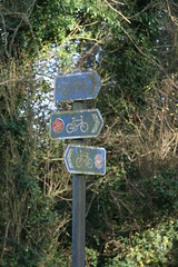
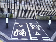
A year ago I documented my cycling resolutions for 2009, so there is no getting away from knowing which ones I achieved and which ones I didn't. It's a bit of a mixed bag.

Unfortunately I failed to reach my goal of covering 3,249 miles. I've ridden 2,854 miles in 2009, which wasn't even as much as I covered in 2008. So that's a shortfall of 395 miles. I've decided to roll the shortfall over and add it to the goal I had already pencilled in for next year. That makes a target for 2010 of 3,759 miles, which gives me something of a challenge to stretch for.

I wanted to reach an Eddington number of 40 in 2009, and I've done slightly better with an Eddington number of 41. That's 41 rides of more than 41 miles since I started counting about two years ago. In 2009 alone I've done 32 rides of more than 32 miles. My mix of rides has changed. I'm doing fewer short rides and more long ones than before. So although I've not covered the total distance that I planned, I have been regularly doing rides of around 50 miles. As a result, the progression to higher Eddington numbers doesn't look too challenging until I get beyond 50. My plan for next year is to get my Eddington number up to 50, which I'm fairly optimistic about achieving. Beyond that it would be good to lay the groundwork for even higher Eddington numbers by ramping up the number of trips of more than 60 miles. This year I've done ten rides of more than 60 miles, so next year I'm going to try and add another 20. That won't affect my Eddington number in the short term, but it should help to prepare the ground for 2011.

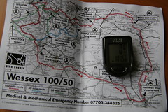
I wanted to do at least one ride of 100 miles this year, and thank's to some friendly support I achieved it. I have a general intention to hit 100 miles in a day at some point in the year, but no specific plans at the moment.

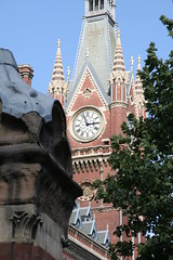
As intended, I managed to visit the next 12 churches on Simon Jenkins' list of England's best. That brings my tally over two years up to 25. Each additional one I visit is a little bit further away than the last, but for the last two years I've reached a dozen well before the end of the year. I'm planning to be a bit more ambitious and try to reach 15 more this year, which will bring the total up to 40.

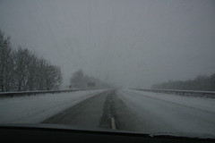
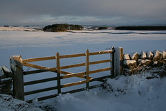
Last year I took time out to ride the Sustrans Coast and Castles route from Newcastle to Edinburgh. It was a great week, and ever since I got back I've been wondering which route to do next. I still haven't made my mind up, but I am looking forward to another week along the same lines, and I hope to fit in at least one overnight trip as well.

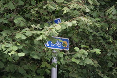
I'm not going to report on how I'm progressing towards the ideal height for my weight. Too little time on the bike in the last few weeks, too much turkey and too many mince pies. I'll take stock of this one in a few weeks time. I also had plans to fill some of the local gaps in Open Street Map, and retrace more of the routes around London that Charles Harper charted in 1902. Neither has worked out quite as I intended, though I have managed to trace some local cycle routes that were missing from OSM, and I've plugged a few gaps around Ascot, and Binfield.

In summary, it would have been nice if I had been able to tick my mileage goal for the year. But in retrospect that doesn't seem terribly important when I set it against lasting memories of the Coast and Castles ride, days out exploring the local area, and the experience of covering 100 miles in a day. It's been fun, and I'm looking forward to more in 2010.

For regular visitors, thanks for sticking with it. And for everyone, best wishes for 2010.

Saturday 26 December 2009

Golden Wheels

A few weeks before Christmas, the Bike show pointed to Tim Dawson's Cycling Books website, which includes a review of The Golden Wheels of Albert Winstanley. That review got the book added to my Christmas list, but since it was published in 1985, I didn't hold out much hope. However, my wife found it somewhere on the Interweb, and it was among the presents that I unwrapped yesterday morning.

The book was written in the 1980's, and seems a little bit old-fashioned for a decade that still feels quite recent to me. But the rest of my family tell me that the 1980's were actually quite a long time ago. In any case the book is a real treat. Albert takes us round some of his favourite rides in the Lake District, Yorkshire Dales and North Lancashire, with one outing to the Pyrenees, and it ends in a French jail.

For someone living in the North-West of England I imagine the book could inspire some outings. From my knowledge of the area, he seems to be picking some attractive destinations, but I suspect that most of his routes involve quite a lot of climbing, and he's certainly not averse to a bit of scrambling off the road.

There is a bit of a story to most of the 22 rides in the book. Albert likes to construct reasons for a particular destination. Often these are do with the name of a place (an early example is a cave called Albert, like him), sometimes it's a historical building, or a favourite landscape.

Albert enjoys his picnics, and the pots of coffee that he brews from stream water on a portable stove. He's also a bit of a dreamer, and he paints imaginary pictures from history, such as monks collecting their new shoes in Thorpe.

But the real point of the book is not the destinations, the routes, the histories, or Albert's eating habits. Above all, Albert conjures a sense of discovery, and enjoyment in each chapter. We get to share the pleasure that he gets from his rides. This is my kind of cycling, so thanks to Jack Thurston, Tim Dawson and my wife, for a good Christmas present.


There's an article about Albert here

Sunday 20 December 2009

M6


For reasons that we don't need to go into, this weekend has involved driving from the south of England to the north, and then back again.

The weather forecast wasn't good, but I worked out that if I took the more westerly route on the way up I would avoid the worst of the weather, and that worked out OK. Coming back I thought the same strategy would be best ,but that may have been a mistake. In retrospect, it sounds as though the route down the east of the Pennines might have been a bit easier today.

Paise Dyke, near HexhamWhen we set off from Northumberland this morning the mix of sunshine and snow made for some glorious views, but from Carlisle we were racing bad weather on the way down. Somewhere between Penrith and Lancaster the snow caught up with us, and that made for a difficult journey down the M6 through the south of Cumbria and the north of Lancashire.


In the end, we arrived home safely, and things could have been a lot worse. The most sensible thing might have been not to travel at all, but that would have caused other problems. In practice, when things were difficult, everyone on the road was being very sensible, and like our fellow travellers, we just took things slowly through the difficult sections until the weather improved, and the road cleared.

It was certainly an experience, but not one that I'm keen to repeat any time soon.

Saturday 12 December 2009

The famous Wallendas

THE FAMOUS WALLENDAS


"Circus enthusiasts the world over have been thrilled by the great Wallendas."

"Their sense of balance is nothing short of amazing"

"If they weren't actually doing it before your eyes you would think it was impossible"

From British Pathé in 1937

Friday 11 December 2009

Bike lanes

There's a nice extract from the Guardian's coverage of the UK's first bike lane in 1934 here.

The gist of it is that Hore Belisha, the transport minister (famed for belisha beacons), opened a stretch of Western Avenue in Ealing with bicycle lanes that separated cyclists from motorised traffic. The Cyclists Union wasn't entirely happy with all this, though I'm not clear why.

At the time, cyclists accounted for 1,324 out of 7,202 deaths on the roads in a year (by way of comparison 2008 figures were 115 out of 2,538).

While recognising that cyclists would no longer be able to ride four abreast, the Guardian seemed to be broadly in favour, and at least one letter writer seems to have agreed.

Wednesday 9 December 2009

Free tax advice for entrepreneurs

For my sins, I am having to read some of the analysis leading up to today's pre-budget report, and I've just come across this comment from Tim Gregory. Tim works for Saffery Champness, a firm of accountants who advise owner-managed businesses, wealthy individuals, and the like.

Tim told the FT....

“With a proposed increase in the top rate of tax to 50% (51.5% for earned income), top earners and entrepreneurs are going to shoulder a large burden of tax increases in the coming years, which will inevitably discourage some from putting 100% into helping to rebuild the economy.”

Tim, I think your clients need different advice.

Top earners and entrepreneurs who are in it to rebuild the economy should be delighted that more of their income is going to go to people who need it more than they do. Top earners and entrepreneurs who are in it for the money should work a bit harder so that they can take home as much as they used to. Top earners and entrepreneurs who use their income to measure their worth should just compare pre-tax earnings.

It's the confused and bewildered top earners and entrepreneurs who should be discouraged. And the sooner they stop trying to help the better things should get.

Monday 7 December 2009

Kippers


Much discussion in our house this evening about kippers, herrings and suchlike.

According to Office of National Statistics the North Sea herring population was seriously affected by over-fishing in the 1970s. Fishing was stopped between 1978 and 1982 and this allowed stocks to recover. From the late 1980s there was another decline, but things recovered from the mid-1990s. In 2004 the stock was at the highest level recorded for 40 years.

Unfortunately stocks declined in 2005, and according to Cefas the decline has continued since. Cefas say that North Sea herring stocks have shown enormous fluctuation in the past, but the stock is currently assessed as being at risk of reduced reproductive capacity and being harvested unsustainably.

My two kippers earlier this year shouldn't have done too much harm, but the EU is still limiting the amount that can be caught.
Let's hope things get better for the poor herring in future, so that we can continue to enjoy the occasional kipper from Craster.

Sunday 6 December 2009

Crikey, I'm turning into Norman Geras

Normblog says exactly what I thought. How scary is that?

"There was a Guardian editorial in praise of Paul McCartney, and it gave as an example of his 'effortlessly fluent' lyricism the second line of 'Penny Lane', which it rendered thus:

Of every head he's had the pleasure to know

No, I said to myself, that's not right. And I Googled for confirmation. But instead of confirmation, I got disconfirmation and this:

In Penny Lane there is a barber showing photographs
Of every head he's had the pleasure to know"

I thought it was "pleasure to have known" as well. It isn't

Why bother?

Tracing stuff for OSM is an excuse to get out on the bike, get some relaxing exercise, explore places that I wouldn't otherwise visit, and learn a bit more about the area where I now live, and its history. As I add stuff, I tick it off my list of local things that are missing from the map, because doing this also satisfies my urge to see things completed. I also like to think that I am sharing something which is going to be of value to others. So my reasons aren't entirely selfish.

It's been bugging me that I never finished plotting the Harding cycle route near Amersham that I began to add back in September. Since then I've finished the other two cycle routes that make up the three loops of the Chiltern Heritage Cycle Trail. As they were rendered on OSM, bits of the Harding route were left dangling, which looked wrong.

So yesterday I thought I would try to close the two remaining gaps in the Harding route. One ran northwards from Chesham through Asheridge to St Leonards. The other ran eastwards from Amersham towards Chenies. I'd missed both parts last time because I'd got myself confused with the signage on the ground, and drifted off route. This time, though, I managed to follow both.

It baffles me how I lost the stretch between Amersham and Chenies last time. It's perfectly well signed, and quite straightforward. Presumably I was tired, or distracted at a critical point. This time I misread things at one stage, and dithered a bit, but apart from that it was easy enough to follow the route. It wasn't so easy to cycle a very muddy and slippery bridleway through the woods on a bike designed for the road though.

I can understand better how I lost the stretch from Chesham to St Leonards last time, because the route through Chesham is a bit convoluted. I've now had a few chances to untangle how this works, but until yesterday I never really got it. This time I finally did, but it still meant frequent stops to check the instructions in the leaflet, and a certain amount of back tracking. After Chesham things are much more straightforward. The only challenge was that the road was flooded in a couple of places, so I got the chance to swoosh through a couple of inches of water with my feet off the pedals. Great fun.

Quite a bit of the route that I was following is also Sustrans regional route 30, so I've added that as well. Some of the route 30 signs are very clear, and look quite new, but between Chesham and Amersham they appeared to disappear and then reappear, so I'm not absolutely sure that I've got it right. Looking at the Sustrans map of the area, they seem to leave out bits of the various routes that are properly signed on the ground, and the bits they have plotted don't always match up with what I saw on the ground. Maybe there are a lot of changes going on, or maybe I'm not the only one who is struggling to untangle all the cycle routes in the area.

I hope that spending a day trying to plot this stuff is going to be useful to somebody, but whether it is or not, I selfishly had the benefit of a good 60 miles riding over fairly hilly landscape. I left the daily grind well behind me, got home tired, had a great night's sleep, and my legs are feeling the effects this morning. The weather wasn't perfect. It was dry to begin with, but drizzle turned to rain on my way home, and I was soaked by the time I got in. But I enjoyed the ride through some decent countryside, with decent views. We'll see how the results are rendered in a few days time, but however they turn out, it was well worth the effort, just for the day out.

Friday 4 December 2009

Pubs

There's a nice post here about the proportion of pubs that can be found on Open Street Map. It seems that more than 60% of Britain's 53,466 pubs still need to be added (based on data from OSM and the Guardian).

I have to admit that recently I've not been doing as much as I would like to support this part of the UK economy, but I have noticed a lot of pubs that have recently closed around here.

Saturday 28 November 2009

Fungi

Today I had a final go at completing my trace of the Hampden cycle route in Buckinghamshire. I rode out to Holmer Green, then worked my way round to South Heath near Great Missenden to join up the parts of the route that I had traced previously (and fix a few of my errors). The village of South Heath, where I finally closed the loop, has already been beautifully mapped on OSM, with a remarkable amount of detail.

There's a network of national, regional and local cycle routes in the area. They interlink and overlap a lot, which doesn't always work out too well when the map is rendered. Most of them are already on OSM, but the odd one is incomplete, so once I had joined up the Hampden route I traced Sustrans regional route 3 from South Heath back into Chesham. It was getting late by then, so riding the 15 miles or so back home in the dark was interesting.

A lot of my route was alongside woodland, and I saw an astonishing number of huge mushrooms. I don't know if this is a particularly good year for them but they were certainly larger and more numerous than I can remember seeing before.

All in all, it was a very pleasant ride of fifty miles or so. Two of the local Buckinghamshire millenium cycle routes should now be complete on OSM, though it will take a few days for them to render. I've still got the last one to finish.

I like the Hampden route for the views and for some pleasant villages, but I think I saw the best of it on my first attempt. That sounds a bit churlish, when I have just ridden through some of the most desirable residential areas in this part of the world. I am sure they are wonderful places to live, and there is certainly a good mix of attractive housing. Just a bit too much on a cycle ride. The mushrooms were more memorable.

Wednesday 25 November 2009

Previously on Hampden...

A week or so ago I followed the Hampden Cycle route from Amersham, North through Chesham, then North-West to Chartridge, and Lee Common, then down to Great Missenden and across to Prestwood. I was tracing it to plot on OSM. But after covering three quarters of the route, time ran out, and I bailed out and left the rest for another day. Today was that day.

My brother lives in Cumbria, so I mustn't call the recent weather round here anything worse than "iffy". So, after several days of iffy weather, when the bike was resting in the shed, I decided it was time to bunk off this afternoon and see if I could complete the circuit. I almost made it.

I had planned to go back to Prestwood then work my way anti-clockwise round the last section of the route back to Amersham.

Unfortunately I didn't get away until after lunch. Then after Beaconsfield I realised that I had left my maps at home. I had the GPS, of course, but even with that, navigating to connect up with my vague memory of where the previous effort had left off was going to be a bit hit-and-miss. I though it would be easier to start at Amersham, where the official route begins and ends, then work work anti-clockwise by following the signs round to where I had left off before.

That went fairly well. I picked up the route easily, so I was able to follow the signs without the help of a map. The weather was more-or-less OK. I discovered I was a bit slow, after more than a week off the bike. But I gradually got into my stride (if that's the right term on a bike) and I enjoyed the views. A bit of relaxing exercise didn't do any harm either.

The village houses looked particularly welcoming as it began to get dark and their lights came on. Unfortunately darkness must also have made it increasingly difficult to spot all the signs. I now know that I drifted off the route about a mile from connecting up with my previous effort - so there is still a short gap left to fill.

However, it is getting there. All but a short length of road was already on the map, but the cycle route wasn't, so Iv'e been able to add that. I like the countryside round there. So its no great imposition to have to go back in future and connect things up. A few hours and 40 miles of trundling around has probably done me the world of good.

I should do this more often. I really should.

Tuesday 17 November 2009

Oh dear


Ipsos Mori on trust. Less than half of us trust pollsters.

Sunday 15 November 2009

John Hampden

This is John Hampden, who was a 17th century politician. He played a leading role in early parliaments, and he was killed during the civil war. I can't help feeling that I should know more about him, but I don't. These people do though.

The reason he is here is that today I set off to map the Hampden cycle route in Buckinghamshire for the OSM cycle map. It is one of three loops that make up the Chiltern Heritage Cycling Trail. The Hampden route runs for 25 miles or so, to the northwest of Amersham. It is named after John - he didn't mark it out, because he didn't have a bicycle. But he lived in the area and represented a nearby constituency.


Hampden routeThis was the local council's Millennium project, so there has been plenty time for moss to grow on the signs. Helpfully that shows which way we are heading because moss always grows on the north side. Or is it the south?

Either way it is a nice route, through some pretty villages, with some good views. I covered most of it today, and I look forward to going back soon to do the rest.


Wednesday 11 November 2009

Take cover

Monday 9 November 2009

£10m cycling investment

The Department for Transport has announced funding for Cycling Demonstration Towns (Blackpool, Cambridge, Colchester, Chester, Leighton-Linslade, Shrewsbury, Southend, Southport, Stoke-on-Trent, Woking and York), a demonstration project in the Peak District National Park, and some extra funding for Sustrans to install cycle parking and cycling links to schools.

I don't think this is new money, it's just putting flesh on funding that has already been announced. That's not a reason for knocking it though.

The nearest projects to us seem to be links to the Basingstoke canal in Woking.

They've also produced a guide to best practice for local authorities, which claims that walking and cycling schemes can deliver cost/benefit ratios ranging from 18.5 to 38.4 (for every pound spent the benefits can be worth £18.50 to £38.40).

There is a lot of information on the DfT web site, and I haven't read it all yet: the press release, an assessment of the first wave of cycling towns, and the guide for local authorities.

House rules

Connoisseurs of the unique Daily Mail take on the world ought to examine the house rules for commenting on their web site, before reading this article on cyclists (link provided by Real Cycling).

  • We want our readers to see and understand different points of view”
  • “You can express a strong opinion but please do not go over the top”
  • “You must not make or encourage comments which are: defamatory, false or misleading; insulting, threatening or abusive; obscene or of a sexual nature; offensive, racist, sexist, homophobic or discriminatory against any religions or other groups"
  • "You must not pretend to be someone else (e.g. an expert....)"

Saturday 7 November 2009

Ashmolean, Oxford


The Ashmolean museum in Oxford has been one of my favourites for a long time. Recently it has benefitted from the investment of a lot of money and effort, and this week it re-opened to the public.

Off we went, and we were delighted. We feared that it would be too busy, but it easily absorbed the influx of visitors, and the new displays are wonderful. It would be hopeless to try and describe everything, so I will just say that if you get the chance you should go and see for yourself.

After a few hours we had taken in all that we would cope with, so we went for lunch, had a long walk, and then dropped into another favourite (Pitt Rivers Museum), before heading home.

Pitt Rivers, Oxford

It was a very good day.

Thursday 5 November 2009

Utterly depressing Flickr group


Another collection of bad cycle lanes, from the Guardian.

The original is here

And there's a poll on cycle lanes here. Please treat it with respect.

Tuesday 3 November 2009

Argleton

From todays Guardian -

"Argleton doesn't actually exist. It is a phantom village that appears on Google Maps. You can search online for Argleton's local weather forecast (10C yesterday), property prices (not much for sale at the moment) or for the number of a local plumber, but in reality the village's coordinates point to little more than a muddy field."


View Larger Map


Good things here

Monday 2 November 2009

Banquet in the iguanodon


I couldn't resist adding this picture to yesterday's post about the dinosaurs at Crystal Palace.

Sunday 1 November 2009

Dinosaurs


The Crystal Palace Dinosaurs are sculptures that were commissioned in 1852 and unveiled in 1854. When the Crystal Palace was moved to Sydenham Hill after the Great Exhibition, the new Crystal Palace Company commissioned Benjamin Waterhouse (a sculptor) and Sir Richard Owen (a biologist and palaeontologist) to build life-sized models of extinct animals. In the end, the funding ran out, and some of the planned sculptures remained uncompleted.

The reconstructions were based on fossils from the Natural History Museum, and skeletons of modern animals. They predated the publication of Darwin's Origin of Species by several years, and at the time were controversial. Within 40 years, science had moved on, and the models were recognised as being unrealistic. They fell into disrepair, but were restored in 2002, and were grade-1 listed in 2007.

When I was a child I had a dinosaur book with pictures of these, and I have waited for almost half a century to see the real thing. Today I finally made it. After all that time, I was prepared to be disappointed, and slightly surprised that I wasn't.

There's more here, here, here, here, and elsewhere.

Saturday 31 October 2009

Halloween


The weather forecast for tomorrow is a bit horrible, so if I was going to manage a long ride this weekend, it meant I needed to make an early start today. As happens far too often, things didn't quite work out that way. I still hadn't set off by lunchtime, so I wanted to find a fairly short afternoon ride, that got me home before darkness fell, and the ghosts and ghoulies came out.

I decided to map the bits of Binfield that were still missing from OSM. Around here, Bracknell is one of the few areas with relatively low coverage on OSM, but taking on the town itself looked a bit daunting. Binfield is a village on the edge of Bracknell, and it looked a more manageable size.

A half day outing, and a 25 mile ride got me out there, around most of the areas that were missing from the map, and back home again. The journey there and back was very nice, with the trees looking particularly gorgeous this year. But if anyone from Binfield reads this, I hope they will forgive me for saying that, while it seems pleasant enough, it's not a particularly interesting destination. The biggest novelty was discovering how many houses had been decorated for halloween. There were huge spiders, gigantic webs, gravestones in the gardens, and stuff like that all over the place. I don't remember seeing anything like it before.

Now I am home I've added the traces of the roads (but not the spiders) to Open Street Map. At the level of detail that I collect, I think Binfield is pretty much complete. So next time I feel like a half day filling gaps on the map I fear it will have to be Bracknell itself. Unless I come up with a better idea by then.

(PS the picture has nothing to do with Binfield, but it seemed appropriate for the date)

SMIDSY


Friday 30 October 2009

Don't keep calm and carry on.


For no good reason, except that I like this. There's more here.
Good advice for 2009

Thursday 29 October 2009

Milton route, the clod's cut


Cycle map has now rendered my efforts last weekend to trace the Milton Cycle Route in Buckinghamshire. As a result I can now see where I made a couple of errors (paradise lost). I've fixed them in the database today, but it will be another week before it is rendered again, and I won't see whether the fixes worked (paradise regained) until next thursday. Meanwhile the glitches are almost cunningly hidden by a page curl in the image above. They will be visible to all on the tile server for the next week.

My little contributions are a tiny pimple on the mass of information that has been produced collectively for OSM. It's a slight disappointment when I don't get it quite right, but it still pleases me to see my efforts appear. Nowadays, Mapnik renders database changes almost immediately, but that doesn't help a lot when adding cycle routes to existing ways. The cycle map only seems to render on Thursdays. The wait is a bit frustrating, and it's a little embarrassing to know that my mistakes will be around for a few more days, but there are also some advantages to this delay in the process. The sense of anticipation lasts for longer. More importantly, by the time I see the results from one weekend, another weekend is looming. The results of one edit are a bit of an encouragement to get out on the bike and fix the next gap on my to-do list. Let's hope for decent weather this coming weekend.

Monday 26 October 2009

Visualising traffic data

I'm not sure if it is the original quality of the video, or a lot of activity slowing down the server, but this is a bit difficult to view. It's worth the effort though, for some stonking visualisation of traffic data.

There is more about it all here.

Sunday 25 October 2009

Milton route, director's cut


I plotted bits of the Milton cycle route last weekend, and today I think I've managed to trace the rest. We'll see what it looks like when the OSM cycle map is rendered later in the week. At the moment it's a bit of a mess because I made a mistake in tagging last week.

Apart from getting caught in one shower, and a bit of a gusty wind today wasn't at all bad for a ride; and because of the clocks going back I managed to make quite an early start, and for once I was home in plenty of time for dinner.

The route meanders around Penn, Amersham, Chorleywood, and the Chalfonts. I rode through Beaconsfield on the way there and back. Some of the best parts were riding through autumn woodland, particularly here in Philipshill Wood. At one point I got mixed up with a bunch of runners, who were involved in a big event. Lots of people had come out to cheer then on, and for several miles it felt as though I had a crowd of supporters.

I enjoyed the day, but I have mixed feelings about the route itself. It covers an interesting variety of landscape and some pleasant towns and villages. But there are too many suburbs for my liking. It's probably inevitable in the Chilterns that the route is quite hilly, but it is also a bit complicated. There were too many junctions where I needed to check the map, and so many changes of direction that it was difficult to keep track of where I was heading. There are several off-road stretches that don't really work with a road bike, and although they could be bypassed, that would mean missing some of the best parts of the ride.

The route borders on a number of fairly large towns, and I suspect it would suit someone who lived locally, who wanted to get to know the area better. Coming from further afield, there are more interesting alternatives.

Thursday 22 October 2009

Improving road safety for pedestrians and cyclists in Great Britain

The full report by the House of Commons Public Accounts Committee can be found here.

It is more fun to read the whole thing, rather than wasting effort on the bizarre and inaccurate press reporting from the usual organs. Especially the transcript of the oral evidence where MPs quiz the Permanent Secretary, and Head of the Road User Safety Division from the Department for Transport. It reads a bit like a rancid blog.

The following exchange pretty much captures the tone....
  • Q18 Mr Curry (MP for Skipton & Ripon): No, you have got the wrong question, I am sorry. Why are cyclists such irresponsible and arrogant road-users? The only time I have been knocked down in my life was by a cyclist going like a bat out of hell outside the House of Commons, dressed like Darth Vader, as they all do! Many people think that cyclists are hugely irresponsible, that they do not take any notice of the red lights, they think that road traffic cones are not for them, it is very competitive and that they are dangerous.
  • Mr Devereux (DfT Permanent Secretary) There are, without doubt, some elements of the cycling community who are in that position and there are equally, I imagine, rather more people who are far more dangerous drivers as well. The population is not homogeneous, as you well know, and cyclists—
  • Q19 Mr Curry: If a cyclist or any driver of a car drove his car like cyclists ride their bikes, there would be nobody left on the roads of Britain at all.
  • Mr Devereux: Sorry, you are assuming that all cyclists cycle the way the dangerous cyclist who went past you—
  • Q20 Mr Curry: No, I am not. I am saying that far too many are. We seem to regard cyclists as living in some sort of superior moral category when they actually do not have any.
  • Mr Devereux: I do not accept that.
Good to see our elected representatives informed by a broad sense of perspective, and resisting the temptation to be influenced by anecdotal evidence of a single incident. As in "Wouldn't it be good to see..."


There is some excellent CTC stuff on all this here and here

Tuesday 20 October 2009

'tis the season...


..for the press to publish articles about cycling in winter weather.

This morning I turned to one in today's Guardian, but it's almost all about fashionable winter cycling clothes. I've already got my gloves to keep my hands warm, and an old anorak to keep the rain off. I think I would look silly in a furry cycling helmet (some would say I look silly enough without one). I might convince myself that I need something more conspicuous for safety on dark evenings, and I've been thinking about investing in a proper winter top, but I've already been mulling that one over since last autumn.

What I really need as the weather changes is plenty of good reasons to brave the elements and get out on the bike.

Of course I've already got my annual mileage goal to work on, and various other targets. I've a list of things that I want to add to Open Street Map. On top of that, Rob Ainsley at Real Cycling is a great source of interesting ideas for slightly off-beat day trips. And if all else fails, I can start working on next year's batch of Jenkins churches. So I'm well prepared to address the "nowhere to go" excuse. But I'm open to other suggestions.

As an encouragement to get out on the bike, it seems to me that the idea for the ride comes first, and the clothing and the equipment are a long way down the list. If you agree, then it would be a public service to suggest compelling ideas for winter rides.

Sunday 18 October 2009

Milton route revisited

After yesterday's fiasco, today I decided to have a another go at tracing the southern part of the Milton route. This is a 25 mile local cycle route in Buckinghamshire that loops southwards from Amersham, through Chalfont Saint Peter, Chalfont Saint Giles, Seer Green, and Penn. It is named after John Milton, who retired to Chalfont Saint Giles to avoid the plague in London.

Yesterday I traced a little bit of the route around Seer Green, but I got horribly lost. Yesterday evening I took another look at the maps, worked out where I had gone wrong, and today I managed to trace the section from Seer Green almost to Penn. In the grand scheme of things none of that is very impressive, but I enjoyed myself, so that's OK.

It was a lovely day for a ride. A little bit nippy, but it was nice sunny autumn weather, and this part of south Buckinghamshire is pleasant. Not all of the route is great, but the woodland where I lost my way yesterday was particularly nice, and I rode through some pleasant villages.

Paradise would be putting it a bit strong, but I didn't get lost. So "Pleasant countryside navigated successfully" would be a bit more accurate than "Paradise Lost". If only John Milton had worked harder on his cadence and navigation skills, and wasted less time on blank verse he might have made a name for himself.

Saturday 17 October 2009

Milton Route

What with a weeks holiday, backlog at work, and various other distractions my cycling log is all going a bit pear shaped. I've fallen behind plan again, and this weekend I'm making a concerted effort to get things back on track. I need to cover a lot of miles, and I am out of practice.

Today my plan was to trace the Milton Route in Buckinghamshire. It should have been a ride of about 50 miles - but it didn't quite work out like that.

I started late, my progress was slower than it should have been, and I clearly wasn't going to make it all the way round. So my revised plan was to leave the northern part of the route for another day, and trace the southern part.

I got myself to Seer Green easily enough, and headed off westwards for Penn. When I eventually arrived in Chalfont St Giles (to the north) I realised something was wrong. A quick check on the map, change of direction, and I headed off for Jordans to the south). When I arrived in Chalfont St Giles for a second time I realised something was still wrong.

When I'm driving it is just annoying to get lost. When I'm cycling it's a more of a mixture. Partly I'm baffled about where I went wrong. Partly I'm amused that I was riding round in circles. Partly I just enjoyed pootling around.

I've traced a bit of the route, and if nothing else I suppose I've established that it might be useful to get the rest onto OSM. If I ever get myself organised enough to do it.

Saturday 10 October 2009

Simpson lever chain


The National Cycle museum stand at the Cycle Show was not typical, but it was one of the most interesting and busiest.

The Simpson Lever Chain was invented by William Spears Simpson in 1895.

"The tops of the triangles had cross bars that engaged the perimeter of the rear chain wheel's flange at a much greater distance from the wheel's axis than would an ordinary chain and chain wheel. Thus Simpson could claim that his chain provided more power through greater leverage.

In the fall of 1895, Simpson offered ten-to-one odds that riders with his chain would beat bicyclists with regular chains. Later known as the Chain Matches, these races at the Catford track in London attracted huge crowds estimated between twelve and twenty thousand in June of 1896. Simpson's team not only included the top racers - Tom Linton, Jimmy Michael, and Constant Huret - but also the Gladiator pacing team brought over from Paris. Pacers enabled a racer to ride faster by shielding him from air resistance. Although Simpson won the Chain Matches, they only proved that the Gladiator pacers were superior to their English rivals."

There is more about the Simpson chain here and here. There is a very clear explanation in French here (roughly - "it is composed of a series of triangles. The inner hinges of the chain engage with the gear at the pedals, and the outer ones with the rear wheel").

"If it has merits, now is an appropriate season to consider its possible future influence. If it has none, it will disappear into the limbo of forgotten novelties."

And it did.

Cycle show


I spent a few hours mooching around the Cycle show today, and there was a lot to see.

The biggest stands from major manufacturers didn't seem quite as big as last year, but there were a lot of specialised products of different kinds; lots of folding bikes, and fixies; several different electric bikes; and what felt like a lot of retro design.

There was quite a bit of cycle mapping. I bought some Sustrans route maps to help work out which trip to do next spring, and I picked up a few TfL cycle maps for weekend outings. There were digital maps from Memory Map; and GPS devices from Garmin and others. I had a bit of a play with a Garmin Oregon loaded with OS maps. It seemed nicely designed, and easy to use, but suspect it is of more practical use to walkers. Before buying one I would need to be convinced that I could read it while riding a bike. OSM cycle maps on a Garmin don't include all the detail that you get on an Ordnance Survey map, but that seems to be a good thing when you are on the move.

I can't help feeling that the most interesting parts of the show were the slightly odd-ball stands, like the exhibits from the National Cycling Museum - which was one of the busiest stands I visited.

These bikes for the London Cycle Hire scheme were shown on the TfL stand. They look very smart, but a bit heavy. I was told that they ride better than you would expect from looking at them. It will be interesting to find out for myself next year.

Wednesday 7 October 2009

And how right they are

Women find fans of cycling the most attractive.

Cycling came out as the top choice of hobby for prospective partners with 36% voting in its favour; beating football (17%) and rugby (14%).
 Cyclists were also frequently described as ‘kind', ‘considerate' and ‘intelligent'.

From Cycling weekly, a survey by the Cycle Show, and an increasing number of links from insecure male cyclists.

Sunday 4 October 2009

Off-grid


We've just returned from a week in the Coquet Valley. We stayed a few miles from the place in the picture. It's a glorious part of the world. The scenery is beautiful, and it's a handy centre for exploring some of our favourite bits of Northumberland. We had more than our fair share of weather during the week, and I didn't get much cycling done, but we did a lot of walking.

Where we stayed there was no mobile phone signal, and no broadband connection, which has been a bit weird. I hadn't realised how much I've begun to rely on the internet to check bits and pieces, like how long it will take to get somewhere, and whether it will be open when we arrive.

There is quite a bit of Northumberland that still needs to be added to OSM. Others are making more useful contributions, but I thought I might be able to do a little bit, and I did manage to collect a few GPS traces. I wasn't very systematic about it though, so I haven't added a huge amount. Just the odd street, and a few other details.

Wednesday 23 September 2009

Longish day, shortish ride

It was an early start today, dropping my daughter off at Heathrow before dawn to catch her flight, then back home to finish off a particularly complicated report. I emailed that off this afternoon, then I cleared a few things off the pile of unfinished admin. Finally, just as I was preparing to bunk off for a bike ride, the phone rang and I had an interesting discussion about some tricky questions.

Finally I set off on the bike for a short loop round nearby villages, thinking I would try and fill in a couple roads that seemed to be missing from OSM.

But in a state of increasing vagueness I ended up drifting off my planned route andI forgot that I had set out later than I expected. By the time I managed to make my way home it was becoming dark, and the clock was about an hour ahead of where I thought it should be.

It seems a long time since I crawled out of bed. Since then my cycling log has increased by one ride and 16 miles. This lifts the week's tally to almost 60 miles, and the year's tally to more than 2,500 miles. I've plotted the relevant parts of my route on OSM, and soon the map will be a few very short lengths of road nearer to completion. There is one less oustanding report to complete, and the pile of unfinished admin is marginally lower than it was. For a while the household will be down by one daughter, but at least we know that she arrived safely.

Tuesday 22 September 2009

Isn't this neat.


I know nothing about this, but it looks really clever. I saw it here.

Monday 14 September 2009

My first 100 mile ride


The great thing, I'm told, about doing a really long ride is that the sense of achievement comes just from finishing. Which is just as well, because by the time I got back to the start point the car park was almost empty. But it still felt good.

I must start by thanking Mike for talking me into this, for coaching me beforehand, and for supporting me patiently through the ride.

I've been looking forward to this for months with a mix of excitement and anxiety. We drove to the start point up the steep hill that we would have to climb at the end of the ride, and we arrived to find hundreds of serious looking cyclists with some impressive machines. So for about half an hour anxiety was high. But once we got started the first few miles were pretty straightforward, we settled into the ride, and I started to enjoy myself.

By the time we were a third of the way round most of the serious cyclists had whizzed past us, and the rest of us plodded steadily on. The route had been well thought out, it was clearly signed, and well marshalled. It was more hilly than I had expected, but we went through lovely countryside, and some pretty villages. On the way down to Salisbury the weather was perfectly cool and sunny. But after a break, as we worked around Salisbury Plain, the sky clouded over and we hit a bit of a head wind. However, once we reached Devizes the wind had died down again, and I managed a quick turn of speed. After that I was beginning to get seriously tired, but the miles clicking down kept me going. In the final couple of miles It was no surprise when I had to get off and push up Brassknocker Hill. I made it to the end though, and I wasn't the last to finish.

I had a great day, and judging by the state of my legs I might come out of this a bit stronger. But I suspect the real difference is what's changed inside my head. Eighteen months ago, I thought 30 miles was a long ride. A year ago the longest ride I had done was 60 miles, and my average ride was about 15 miles. This year (up to now) I've been quite pleased to do a 50 mile ride almost every week, with an average ride of 25 miles or so. Yesterday has raised the bar. I doubt if I'll do 100 miles very often, but now 50 miles doesn't seem so far. Despite some friendly ribbing I'm not going to be investing in lycra, but I already knew I should work harder on my speed, and yesterday also confirmed that.

Family, friends and colleagues have been generous with encouragement and sponsorship. The organisers and other participants helped to make it an enjoyable day, and Mike made it possible. I normally like to plan my own routes, take my own time, and enjoy my own company on a ride. But yesterday was a reminder that it can sometimes be good to share the experience.

And I could get hooked on Clif bars.

Thursday 10 September 2009

Harding route (2)

Last Saturday I tried to ride round the Harding cycle route near Amersham. I knew I went a bit adrift in a couple of places, but I marked up the sections that I was confident in on OSM. The bits that I plotted have now been rendered on the cycle map. Although it is incomplete I'm quite pleased with the result.

After careful scrutiny of the leaflet and other maps I've managed to figure out where I went wrong as I was following the signs. So I'm now in a better position than I was to fill in the gaps. Having started the process but left gaps, I realise that I'm gradually suckering myself into a series of return visits to complete the Harding route, and then the other two local cycle routes that start from Amersham.

I won't be able to add any more this coming weekend, because Sunday is my attempt on the Wessex 100 (the sponsorship form is here for anyone who wants to support the Anthony Nolan trust). So Amersham will have to wait a bit longer. But completing this and the neighbouring two routes should give me a good excuse for some fine (and fairly energetic) rides over the next month or two.

Tuesday 8 September 2009

Bored with plotting admin boundaries on OSM?


Here is the next project

NHT on routes

Fans of the OSM cycle map might be interested to see how different local authorities are rated in the NHT survey for the information they provide on cycle routes. Darlington comes out well in the survey, and Liverpool does not come out well at all.

Of course, since this is measuring perceptions, rather than reality, it doesn't necessarily correspond to the quality of the information each authority provides.

I dont want to have a Boris experience, so lets say that people in Liverpool hold their council to higher standards than people in Darlington. Or perhaps people in Darlington don't like to grumble to market researchers. Or it could be that Darlington actually does provide better information on cycle routes. There are some oddities. I thought that TfL did all the cycle maps for London (and I think they do a pretty good job of it). But information on cycle routes is rated highly by people in Islington , and poorly by people in in Kensington.

Of the councils that are rated highly in this survey the residents of Milton Keynes and Bristol seem particularly well served. They have pretty good coverage on OSM, and they like their council maps. The council is seen as doing a good job in Darlington and Poole, but neither is particularly well covered by OSM.

OSM provides a good alternative for some of the councils that are not seen as providing good cycle route information themselves. This is particularly true of Liverpool, Torbay and Kensington. Other councils that are seem as weak, such as Northamptonshire, Wallsall, Stockport and Staffordshire are also a bit thin on OSM. Cyclists in Cornwall in particular could do with some help.

If there's a pattern to all this, then it's not one I can see.

The survey data is here, and there is an expanded version of my chart here.

Monday 7 September 2009

NHT

I've just noticed that the 2009 data from the NHT survey are now available. I'm not sure how long they have been there, but I just found them this morning. The NHT survey is a postal survey on transport facilities carried out by IPSOS MORI for a number of local authoritites. Seventy-seven took part in 2009, covering a fair chunk of England, but not including my own local council.

The survey asks a number of questions about how the public sees different aspects of road and transport services, including cycling facilities.

The chart shows the results for the cycling questions in three of the counties where I have done a fair amount of riding this year (click through for a larger version). Oxfordshire ranks highly in general, and particularly well for cycle facilities at work, and cycle parking. Buckinghamshire and Northumberland don't come out so well, though Northumberland isn't rated badly on cycle routes.

The authorities that come out best overall for cycling facilities are Milton Keynes, Poole, and South Gloucestershire. Nowhere round here ranks particularly highly.

The web site, more information on the survey, and the data can be found here

Sunday 6 September 2009

Harding Route


The OSM map for Thame is a bit thin, and my original plan for yesterday's ride had been to cycle there, do a bit of mapping, and cycle home again. But when I realised that someone else is actively working on the town I thought I should find somewhere else. I settled on Amersham, which is a decent ride away, and the starting point for three local cycle routes that I haven't tried yet.

I didn't stay long in Amersham, setting off to ride the "Harding Route". This is named after Thomas Harding, a 16th century religious dissident and martyr. He was a follower of Wycliffe, or a "Lollard" who was sentenced to be burned for his religious beliefs and so tied to a stake at Chesham. Apparently, the priests told people that if they brought wood to burn heretics they would have an indulgence to commit sins for forty days. Once they had lit the fire, someone beat his brains out with a stick.

Happy times.

Anyway, the Harding Route is one of three 25 mile "Heritage" rides around Amersham. This one runs to the north and east. I think they were set up as a millenium project, and they seem to have been well thought out. Certainly this one goes through some nice countryside, and some pretty villages. It's towards the "strenuous" end of my normal range, which means it's hilly enough to be interesting, and then some. Combined with a few tough climbs on the way out to Amersham and the same coming back, I ended up covering just over 60 miles, and by the time I got home I certainly knew I had been for a ride.

The route is reasonably well signed, though some of them are a bit hard to spot. I had to retrace my path a couple of times, and I know I drifted off it at one point. I'm still not sure which bits I followed accurately. As far as I can tell, all the roads I followed are already on Open Street Map, but the cycle route is not marked as such on the map. It shouldn't be too difficult to add it - but I think it's going to need at least one more circuit to be confident of getting it right. Meanwhile the official map is here.

Friday 4 September 2009

The Economist


This week's Economist has an article about digital maps which is quite interesting, except it manages to avoid mentioning OSM. I can't leave a comment on their site without registering, and someone else has already made the point nicely. So this is my contribution.

I think a link to the OSM cycle map of the area around the Economist offices conveys the message more eloquently than I ever could in words.


Update: encouraged by chilly, I've also commented on the Economist now with a link to the OSM cycle map.

Wednesday 2 September 2009

Apology from Wired

I've had a nice apology this evening from the Gadgetlab editor at Wired about using my photo to illustrate their article on OSM.

Apparently their legal team interprets the Creative Commons "noncommercial" license as allowing editorial use in news stories. I find that a bit surprising, but who am I to argue?

Anyway, they say they don't want to upset me so they have replaced my picture with another contribution from a Flickr account that applies different license restrictions. I can't fault them for that, and personally I think they now have a better illustration. You can see it here. The picture they originally used is here.

Tuesday 1 September 2009

August round-up


Four months ago I had just finished my week's ride from Newcastle to Edinburgh, and I'd covered just under 1,200 miles in the first four months of the year. Four months on and my total for the year has now passed 2,200 miles. To reach my goal of 3,249 miles over the year, that leaves just over 1,000 miles to cover in the next four months I'm just ahead of plan.

In the last four months I've also completed this year's Jenkin's quest. Meaning that since the beginning of last year I've used the bike to visit 25 of the best English churches ranked by distance from home. Every time I reach one the distance to the next is a bit further. Each round-trip is now approaching 60 miles, so I've put that project to one side until next year.

So my longer weekend trips are now a mixture. I've been taking advantage of return trips on the train to reach more distant centres, such as Oxford and Winchester, which encourage me to explore new routes. I've also been trying to map some of the gaps in OSM, which means I'm learning more about the local area. And I've fitted in a few interesting destinations and routes, like the Wey Navigation.

Overall I'm covering greater distances, in fewer, longer rides. I hadn't ridden 100km until earlier this year, but now I've done it five times. I've covered my age in kilometres 25 times, and in miles 11 times this year. So my Eddington number is up to 40.

I'm planning to do a 100 mile ride in a couple of weeks time, and that will be the next big challenge. Meanwhile I'm quite pleased with how things are going. My fear was that I would lose interest, and things would tail off, but there's no sign of that happening. Just the opposite. As the rides get more demanding they get more interesting. Where will it all end?

Monday 31 August 2009

Turville & Hambleden

A nice ride this afternoon joining up bits of recent rides with an old favourite, for a 38 mile loop round Henley, Christmas Common, Turville, Hambleden and Marlow. After a grey morning the weather turned sunny and wam this afternoon. It was a little bit windy, but otherwise nothing to grumble about.

It's quite a hilly route, but the glide down through the woods from North End to Turville for a couple of miles more than compensates for the climb up from Henley to North End. I'm not so sure about the lumpy bits between Hambleden and Marlow. The local cycle route through Rotten Row and Bovingdon Green is a great improvement over the A4155 that I used to follow, but the climbs are still a bit too steep for comfort. Maybe in time I'll get in better shape, and they will seem less crinkly, but I'm not there yet, and I seem to remember feeling the same way months ago.

They were serving teas in the churchyard at Hambleden, so I stopped and had a cup of coffee and a slice of fruit cake (I don't like tea). That was a very pleasant break, and the whole outing was good, but the ride down through the woods from North End to Turville was the best bit. It's a steady downward slope, on a narow road that is completely enclosed by trees. The trees made it quite dark, but the sun was breaking through gaps in the cover, and there were glimpses of views down the valley. I kept thinking I should stop to take a photo, but I was having too much fun. So for illustration an extract from the OSM cycle map will have to do instead.

Saturday 29 August 2009

When possible make a U-turn


The GPS knows about the short-cut through town, but it doesn't know that a mile further along Regional Cycle Route 52 I can get an ice-cream, and spend twenty minutes watching the boats squeezing through Boulter's lock.

Saint Pancras

St Pancras Station, clock tower
I had a meeting in King's Cross this week, and afterwards I dragged my colleagues round to Saint Pancras for a coffee. At the time it was built such Victorian archtecture was considered brash and vulgar - a bit of a mishmash of styles. Now it is widely regarded as a masterpiece. While I'm not sure my colleagues agreed, I think it is a delight, they've done a wonderful job of the restoration and it's well worth a walk round the block for an eyeful.

I was reminded of this today because I've been back to Ascot, Sunninghill and Sunningdale to fill more gaps in Open Street Map. Each of these neighbouring towns has quite a pleasant Victorian village at its core, and an interesting mix of housing, but they are also surrounded by endless estates of enormous and expensive looking new houses. I like the older bits, but I'm afraid I find a lot of the recent building grotesque. Oddly they seem to have fenced most of the residents in with huge railings and locked gates.

One day, perhaps, people will look back at this in the same way as we now look at Saint Pancras, and make diversions to look at a remarkable collection of 21st century domestic compounds. But somehow I doubt it.

I know that I've not managed to get all the roads traced that were missing from the map, but I think I've now got a pretty fair proportion. It was a good day for a ride, but I found some of it a bit depressing, and I won't be rushing back.

Friday 28 August 2009

Wired


Wired have used my photo of an OSM cycle map on my Garmin to illustrate a recent article. The link is here. It's not a bad article.

I quite like Wired, so I am hugely flattered that they chose my picture, and pleased that they have attributed it. But I'm a bit surprised that a publication like that didn't take more care over the license restrictions, which specify "non-commercial use".

I've emailed them to that effect, offering to send details of where to send payment, if only in recognition of the importance of the licensing system, and the rights of commercial photographers. I will report results.

Sunday 23 August 2009

Arbitrary and meaningless?

A comment on the OSM Talk-GB lists has got me thinking. It was part of discussion on creating local "chapters" to represent OSM. That's not a subject that particularly interests me, and the comment was a bit of a sideline to the main thread anyway. But I was struck by the thought that such chapters should be organised around "real" regions, not "arbitrary" and "meaningless" government boundaries.

The connection is that I've been closing some of the gaps in the local government boundaries to make my estimates of OSM coverage work. Chasing down the gaps showed just how many different paths the boundaries follow. Most often they track some feature in the landscape: usually a river or a stream. Many follow parts of the transport infrastructure, including a lot of roads and some railways (some follow the path of a railway that is no longer there). Near to where I was mapping yesterday part of the boundary for Bracknell Forest (council created 35 years ago) follows the path of a Roman Road (laid out 2,000 years ago). Some boundaries seem to have been adjusted to surround new housing developments, or follow more recent infrastructure such as a motorway. Others just snake across the countryside, following a route that has no apparent rationale at all.

It certainly ends up looking a bit mad. But of course it isn't really arbitrary or meaningless. It's the result of a whole series of decisions that date back at least to Saxon times (for shire counties), and medieval times (for towns). More recently there have been a couple of hundred years of trying to reform all this, and adapt to the effect of the industrial revolution and subsequent change. Right up to the creation of new unitaries earlier this year. At the time, each individual decision must have made some kind of sense, even if they now look arbitrary and meaningless to our eyes.

I am getting to the age when I ought to start grumbling about everything going to the dogs, but I don't have much sympathy with the view that local authorities have to be preserved as part of our national heritage. They are there to serve a practical purpose, not a ceremonial one. Like language they have to adapt to changing needs. And I doubt many of the existing boundaries have had any kind of democratic basis. Existing structures have pretty much been imposed on us: by power struggles between modern politicians, Victorian industrialists, Medieval bishops, Norman lords, Saxon Earls, and even Roman soldiers.

No doubt when the Martians invade they will impose new and more "rational" boundaries on us - just as the Normans did to the Saxons, and just as Napoleon did to much of Europe a couple of hundred years ago. Drawing up new boundaries is a neat way to break up an existing power base.

Certainly a few lines on the map are never going to reflect all the different "real" geographies out there, and "English administrative boundaries: the first 2,000 years" is unlikely to make the best-seller lists. But the boundaries we have today carry all the mess and inconsistency of their history. That's not a reason to preserve them, but until the Martians arrive, I reckon we ought to celebrate it.

Saturday 22 August 2009

A day at Ascot

I estimate that about 80km of roads in my local authority (Windsor & Maidenhead) have not yet been added to Open Street Map. In comparison to other places in England that's not too bad - 89% of roads are already there. But compared to some other parts of South-east England it looks a bit thin.

The issue of course, is to find the missing roads, trace them, and get them added. Some of them are isolated gaps, and those are going to take the most effort to reach and trace. But there are also some areas with a bit of a cluster of missing roads. In this part of the world, the residential areas around Ascot and Sunninghill look like the best opportunity to do some useful mapping without chasing around all over the place.

It took a couple of hours riding to get out there, but in the process I managed to plot a few of the isolated gaps. I did the same on the way back, but the bulk of the afternoon was looping around an interesting mix of different residential areas. I reckon I've managed to trace a reasonable proportion of what was missing from the bottom right-hand corner of the Windsor & Maidenhead authority, and I'm all geared up to add them to OSM. Unfortunately it's down for maintenance this weekend, so I will just have to wait.

Friday 21 August 2009

OSM coverage in Scotland and Wales

Name |Coverage
Isle of Anglesey | 124%
Gwynedd | 71%
Conwy and Denbighshire | 54%
South West Wales | 60%
Central Valleys | 43%
Gwent Valleys | 35%
Bridgend and Neath Port Talbot | 65%
Swansea | 77%
Monmouthshire and Newport | 72%
Cardiff and Vale of Glamorgan | 79%
Flintshire and Wrexham | 87%
Powys | 50%


Angus and Dundee City | 56%
Clackmannanshire and Fife | 51%
East Lothian and Midlothian | 65%
Scottish Borders | 60%
Edinburgh, City of | 99%
Falkirk | 55%
Perth & Kinross and Stirling | 66%
West Lothian | 64%
East Dunbartonshire, West Dunbartonshire and Helensburgh & Lomond | 66%
Dumfries & Galloway | 51%
East Ayrshire and North Ayrshire mainland | 42%
Glasgow City | 86%
Inverclyde, East Renfrewshire and Renfrewshire | 70%
North Lanarkshire | 55%
South Ayrshire | 48%
South Lanarkshire | 58%
Aberdeen City and Aberdeenshire | 46%
Caithness & Sutherland and Ross & Cromarty | 64% *
Inverness & Nairn and Moray, Badenoch & Strathspey | 64% *
Lochaber, Skye & Lochalsh, Arran & Cumbrae and Argyll & Bute | 64% *
Eilean Siar (Western Isles) | 67%
Orkney Islands | 29%
Shetland Islands | 48%

(*) = Average across three regions

Coverage = (length of roads plotted in OSM across the region) / (DfT figures for the length of road in the local authorities that make up the region)

Thursday 20 August 2009

OSM coverage in Scotand and Wales


I've had a first attempt at measuring OSM coverage in Scotland and Wales using NUTS-3 regional boundaries as the common ground to compare Department for Transport statistics on the length of roads in a local authority against the length of roads plotted on OSM.

NUTS is the basis on which the EU publish regional statistics, and they provide the boundaries as shapefiles. The precision isn't as great as you get from admin boundaries on OSM, so this is a stop-gap until the boundaries for local authorities in Scotand and Wales are complete on OSM (or until the Ordnance Survey put them in the public domain).

On the whole the NUTS boundaries match up reasonably well with Local Authority boundaries. In some cases they are the same, in others I can aggregate the road lengths for a few authorities to get the figure for the equivalent NUTS region. It's only in the Scottish highlands where this doesn't work too well, because the local authority for the Highlands crosses several NUTS regions. So I needed to take an average across a big area of northern Scotland.

Nobody seems to like the colouring on this attempt very much, so that will need some more work. But meanwhile, the headlines are that Anglesey and Edinburgh look well covered. Glasgow, Renfrewshire, and Gwynedd look pretty good. While Powys, Aberdeenshire, Orkney and Shetland are looking a bit thin.

For anyone interested in doing a similar exercise elsewhere in Europe, I don't know what detailed figures are published at national level, but there are Eurostat figures for road lengths at the NUTS-2 level (i.e. the next largest geographical grouping after those I am using here). Eurostat only split "Motorways" and "Other Roads" so dealing with dual carriageways etc is going to be a bit iffy. However, I've done a quick comparison of their numbers for the UK, and the rough figures (motorways * 2 + other roads) gives me a total that isn't a million miles away from more detailed calculations. The Eurostat figures are here under "Regional Transport Statistics", and the Eurostat shapefiles that I used are here


There's another version, with brighter colours here

Monday 17 August 2009

Navigation


One of the odd things about the ride I did yesterday was that it crosses four different Ordnance Survey Landranger maps. My "home" sheet (Reading & Windsor) would have got me as far as Slough, though I shouldn't need it for such a familiar route, and it didn't come out of the bag.

From there to the top of the Wey Navigation is on the West London sheet (176) and I checked that one a couple of times, but along the canal itself it only took me as far as the point where the M25 crosses.

Then I was on the Dorking and Reigate sheet (187) almost until I reached Newark lock (in the picture). After that I would have been following the route on the Aldershot & Guildford sheet (186) except that I didn't have a copy of that one.

Not that it particularly matters along a canal of course. Even at my most vague and woolly, it would be quite an achievement to get lost on a towpath. Except for one thing.... approaching Guildford there are a couple of different options, and I suspect I didn't pick the best route into the centre.

Getting home from the centre of Guildford was another matter. My planning for the day had been bit sloppy to put it mildly. Basically I knew that if I headed north I would end up somewhere familiar, and I hadn't given it much more though than that. I've got the OSM cyclemap on the GPS, and since that now has route finding I was pretty relaxed about getting home.

In the event, though, the distance from Guildford to home proved a bit too much for the GPS. I fiddled around with partial routes for a while without too much luck, and in the end I realised I didn't have time to drift much off a straight line, so I went and found a book shop, and bought a copy of the local OS sheet.

That got me as far as Bagshot. Not that it needed much checking since I was now following a main road, with plenty of signposts. From Bagshot I was back on the OS sheet that I had started from, but more importantly, I was on familiar ground, and the GPS route finder was coping, and ticking down the remaining distance. So from Bracknell I was able to call home and let them know (more or less) exactly how late I was going to be.

Unfortunately slippy maps on the internet don't function too well out on the road. The GPS is wonderful, but it isn't really up to finding 20 mile routes on the bike yet (though it is getting there). I am trying to make a convincing case to myself that an Internet tablet with GPS and Maemo Mapper would be just the thing (without much luck). So in reality I suspect that I'm going to be carrying bundles of landranger maps for a while yet.

It seems a bit ironic that all this came to the fore along a canal route call the "navigation".