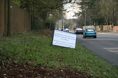
The A4 is a historic road in England, which runs from London to Avonmouth, near Bristol. It was the main route from London to the west of England. As here in Maidenhead it is known for much of the way as the Bath road. It did originally only run as far as Bath, but in 1935 the A36 between Bath and Avonmouth was renumbered as the western end of the A4.
The heyday of the road was in the nineteenth century as a coaching route, up until the arrival of the Great Western Railway, which reached Maidenhead from London in 1838, and linked London and Bristol from 1841.
In 1821 mail coaches were averaging 8.75 mph along here between London and Bath (including stoppages). That's about the same speed as I average over a full day on the bike (including stoppages). They left London at 8pm, and reach Bristol the following morning at 10am.
Fast passenger coaches (stage coaches) were reaching 11 mph or more, and by 1837 there were fifteen passenger coaches a day between London and Bath, as well as two mail coaches. From then on, as the railway extended out towards Reading the start point of the coach journey moved nearer to Bristol, and once the railway was complete the coach services ended.
This picture was taken just east of Maidenhead Thicket, which along with Hounslow Heath (roughly where Heathrow Airport is now) was one of the notorious spots where coaches feared an encounter with highwaymen. The highwaymen at Hounslow heath would target rich travellers going from London to Bath, while those at Maidenhead would target those travelling from Bath to London. Nevertheless, Maidenhead was a popular overnight stopping point for those travelling west who preferred to cross the thicket early in the day (presumably while the highwaymen were still having breakfast).
"The roads of England and Wales: an itinerary for cyclists, tourists, and travellers, containing an original description of the contour and surface with mileage of the main direct and principal cross roads in England and Wales, and Part of Scotland" (which is a blinder of a book title), has this to say about the road between Maidenhead and Twyford in 1898 - "hill to mount out of the town, then first rate level road to Stubbings Heath or Maidenhead Thicket, and the rest is rather hilly by Littlewick Green, Knowl Hill, Kiln Green, and Hare Hatch; capital smooth and hard road. Pretty scenery".
Since the early 1960's the A4 between Maidenhead and London has been been paralleled by the M4 Motorway, which extended as far as Swindon in the early 1970's.
And now, having shifted traffic off onto the railways, and the motorways they are going to cap it all by building a cycleway. It's all part of the local authority plan to encourage pupils to cycle and walk to school, and they hope it will also reduce congestion and parking problems. It involves some new cycle paths, and signage.
I applaud the policy of encouraging cycling. And as I regularly face the problem of crossing this part of the A4 at busy times of day I look forward to the end of March, when I can change my route slightly so that the new toucan crossing speeds me on my way.
Charles Harper - The Bath Road = http://ia341038.us.archive.org/3/items/bathroadhistoryf00harp/bathroadhistoryf00harp.pdf
The roads of England and Wales = http://www.archive.org/details/roadsofenglandwa00howa
Society for All British Road Enthusiasts = http://www.sabre-roads.org.uk/wiki/index.php?title=A4
Motorway database = http://www.cbrd.co.uk/motorway/m4/
A4 Cycleway =
http://www.rbwm.gov.uk/web/news_22609_a4_newlands_cycle_route_west_maidenhead.htm

No comments:
Post a Comment