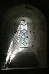
This is the 39th church I have cycled to from my list of notable English churches. I've ordered the list by distance from home, and Compton ranks 36th. It's just over 22 miles away as the crow flies. However, the actual distances from here to Surrey always work out further because it's difficult to find decent routes. Centres like Bracknell, Camberley, Woking and Guildford tend to get in the way, and the whole area is crossed by very busy roads. It's quite a challenge to find a route that isn't too busy or absurdly complicated.
For destinations to the east of Woking I tend to go down the Thames towards Weybridge, then head south. For destinations east of Guildford I work my way through the edges of Woking. But Compton is further to the west, and I was on unfamiliar ground.
I consulted CycleStreets for suggestions, and as usual it came up with some good ideas. But the fastest route suggested a lot of roads that I was already familiar with. The quietest route was complicated. The "balanced route" was a decent compromise, but I thought I could do better by mixing bits of each. I don't know of a way to edit routes from CycleStreets, so I turned to the Bike Route Toaster to recreate the CycleStreets suggestions that I liked. Bike Route Toaster has the added advantage that routes can easily be loaded onto my Garmin Edge.
It's the first time I've tried this, and up to a point it worked well. The glitches were down to me. In the first part of the journey I rediscovered a much quieter route to Bracknell than I've been using recently. And I managed to work my way round Bracknell mostly on cycle paths rather than on busy roads. All that went well. Unfortunately I hadn't been as smart as I thought in the route that I chose south from Bracknell, so I suffered a few miles through heavy traffic on fast roads through Camberley. From then on things went much better. The ride down through Frimley was fairly built up, but interesting. I had realised over breakfast that the final part of my plan went straight up and over the Hog's Back ridge (which didn't look like a great idea). I found a less strenuous alternative along part of the Pilgrims Way (National Cycle Route 22). So for the last few miles I deviated from the route that I'd loaded onto the GPS. It was a good call - the ride along NCR 22 was very pleasant.
Coming back I retraced my steps (steps?) as far as Frimley Green. I didn't fancy battling my way through Camberley again, so I decided to take a wider loop round Bracknell, through Deepcut, Lightwater, Windlesham and Ascot. I hadn't ridden that way before, and it looked like a much longer ride, but it was a lovely afternoon, and I had plenty of time. In the event it wasn't as far as I expected.
The total distance ended up at just over 70 miles.
2 comments:
CycleStreets have route modification on their to-do list. They are looking for donations to hire a developer for 12 months to do things like that.
Thanks for introducing me to Bike Route Toaster.
That's good news Gregory - and thanks for the comment.
Post a Comment