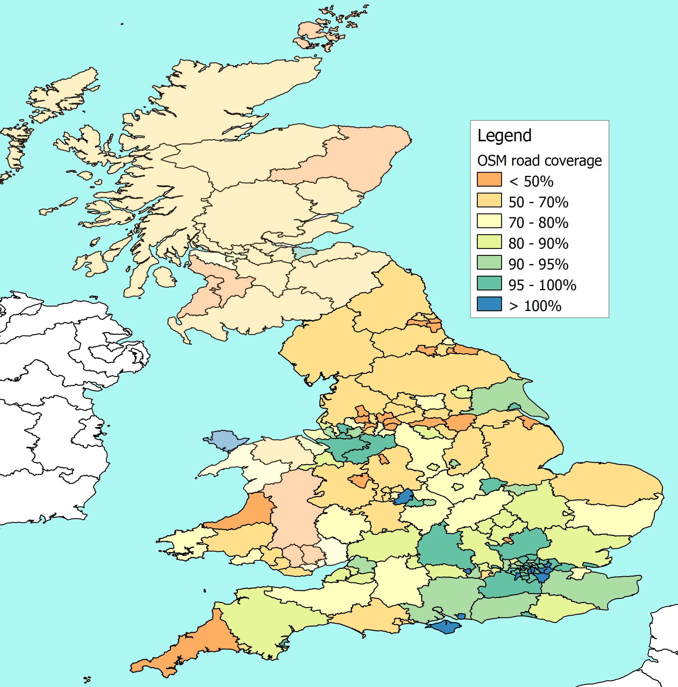
I still can't make this work for all local authorities. That's partly because the data is incomplete, and partly because of mistakes in the way I have collated the data. However, thanks to help from the Talk-GB list, I am begining to get plausible figures for quite a lot of England and some bits of Wales.
It's an interesting exercise - I am learning a lot about Postgresql databases and the Postgis extensions. I haven't finished. There is still work needed to plug the gaps and improve the accuracy, and better examples to aspire to, like this. But I thought an initial view might be timely, even though it is incomplete.
Anyone who hasn't booked their holidays yet can already see that there is work needed on the map in Cornwall, and quite a bit in Cumbria, Northumberland and Norfolk. And Bracknell.
4 comments:
A really great start to a useful process. I am trying to alter the boundaries of counties either side of the River Humber to their real positions, without infringing copyright, so the outlines you have used will change.
Are you expecting to run an update regularly?
Thanks Chris.
Yes I am planning to keep this updated - at least for a while.
It cannot take over from normal life, and it currently takes about two days to extract and load a new version of the extract. That might get better, but I will be refreshing periodically, rather than regularly. I hope I'll pick up your improved boundaries over the next few days.
At the moment each refresh changes the numbers mainly because I am improving the process, not really because the underlying data has improved.
What I am thinking is that over a few cycles my process should stabilise, then it will become possible to measure trends in coverage improving over a longer period. We'll see.
Hmm, I wonder what Scotland would look like? A sea of red, I suspect
I can't tell, I'm afraid because I can't pick up any local government boundaries.
Post a Comment