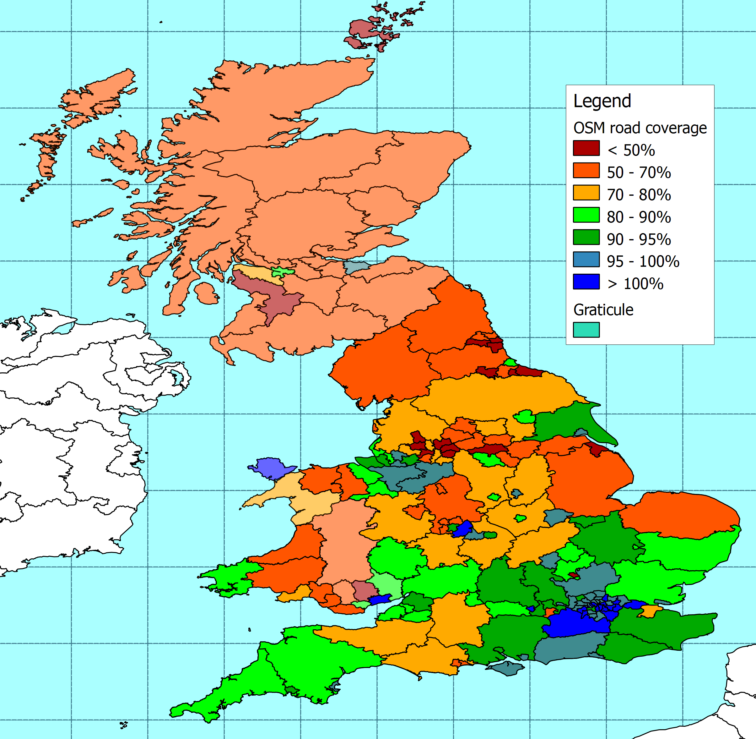
A few months ago I compared the length of roads on the OSM database against the figures quoted by the Department for Transport. I've now updated the analysis using an OSM database extract from the end of 2009. The resulting map is here and the data from the analysis is here. The DfT data can be found here.
In summary, the length of UK roads on OSM has increased by around 5% over the last few months. The south east of England is still generally better covered than the north, but there is improved coverage all over the place.
The biggest increase in coverage is in Cornwall, which has moved from less than 50% coverage to more than 80%. There are also significant improvements in Plymouth, and a number of cities in northern England and the West Midlands.
It's quite nice to feel I have contributed to some improvement around here, but much more impressive to see things moving forward across the rest of the country.
1 comment:
Thanks for taking the trouble to produce this map again. Decent measures like this are a good way to judge progress. Many discussions about 'completeness' take place but this is the real McCoy.
Post a Comment